Roman Settlement Patterns in Western Pannonia
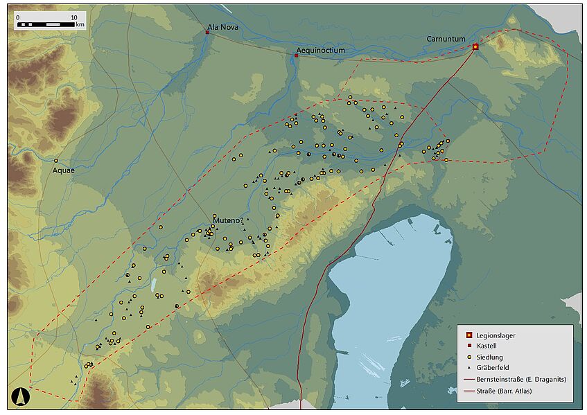
Leitha valley, modern topography and Roman settlements. Settlement data from Luftbildarchiv, Barrington Atlas and E. Draganits. Topographic data derived from Geoland.at 10 m DGM (Creative Commons).
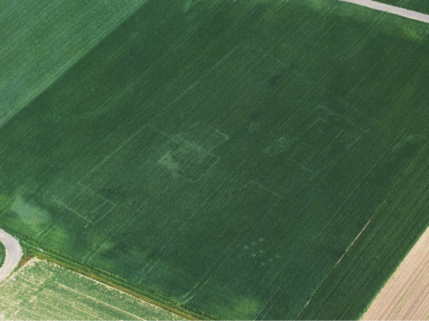
Aerial photography of the Roman villa at Neudörfl, (c) Luftbildarchiv
Roman Settlement Patterns in Western Pannonia
PhD candidate: Benedikt Grammer
Supervisors: Michael Doneus (University of Vienna) and Christian Gugl (Austrian Academy of Sciences)
My PhD project is a remote-sensing based study of the settlement patterns in the Austrian part of the Roman province of Pannonia. It takes full advantage of aerial photography and ALS data to systematically analyze a historic region over the course of the Roman period (1st – 5th century AD). The data basis for this endeavour is provided by the results of the FWF project „Die Kelten im Hinterland von Carnuntum“ (2004–2005). The FWF project aimed at identifying Late Iron Age settlements in the Leithatal by the means of aerial photography and field-surveys, but also managed to identify a great number of Roman sites. The goal of my PhD project is to extend this study area towards the east and north to include the large legionary camp and provincial capital of Carnuntum and conduct a remote sensing prospection in conjunction with field-surveys, using the tested methodological approach of the FWF project. The Aerial Archive hosted by the Institute for Prehistory and Historic Archaeology contains a large amount of aerial photographs available for interpretation.
Expected Roman sites within the area include villae rusticae and vici, burial grounds, roads and military instalments. Additionally the remote sensing process will include a mapping of the palaeochannels of the Leitha river. The river served as both a transport way and fresh water supply for the region and is therefore a primary element of the landscape. It has altered its course considerably in modern times, making the reconstruction of its flow in Roman times of major importance. Features of individual sites are traced in the remote sensing data in order to classify them. A ground-observation of the identified features is carried out to obtain chronological information. This collected find material allows to establish a rough preliminary chronological model of the settlement development. Prior projects have shown that the environmental conditions in the area are excellent for aerial photography prospection. Combined with the sites known from excavations and stray finds, a very high-quality dataset of the Roman sites in the area can be generated.
The quality of this dataset allows for a spatial and statistical analysis using GIS and the programming language R. Questions of land use, classification of rural settlements and the historic development of the region can be discussed on this basis. Of special interest is the transition from Imperial Roman times to Late Antiquity. Methodological issues which are tackled concern data integration, site definition, open access/open data publishing models, and the correlation of archaeological material and historic records.


